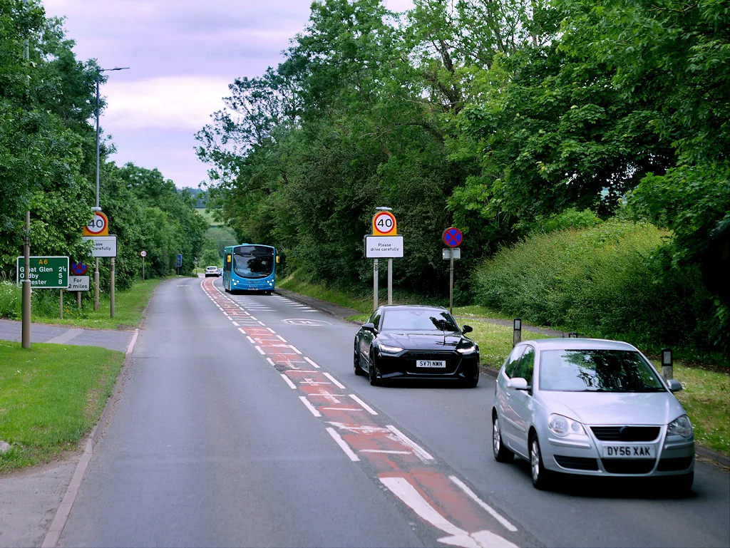

Pollution on the A6 through Kibworth has stayed under the legal limit since 2020, so the council is lifting its air quality zone. See the 2025 readings.
The Kibworths are to lose their Air Quality Management Area after six years of pollution readings below the legal limit on the A6.
Harborough District Council’s Cabinet approved the revocation on Monday 26 October. The zone was declared in November 2017 because of nitrogen dioxide from traffic on the A6. It is the only one in the district.
The council announced the decision on 27 October. It said monitoring will carry on in the Kibworths and across the district, and that it will start work on a new Air Quality Strategy.
What the readings show
The council measures nitrogen dioxide with small diffusion tubes fixed to lamp posts and road signs. It has 10 long-term tubes in the Kibworths, plus an automatic monitor beside the A6 since 2019. The legal limit is an annual average of 40 micrograms per cubic metre.
When the zone was declared, the highest reading was 55. That figure is in Table 2.1 of the council’s 2026 Air Quality Annual Status Report, which went to Cabinet as Appendix A.
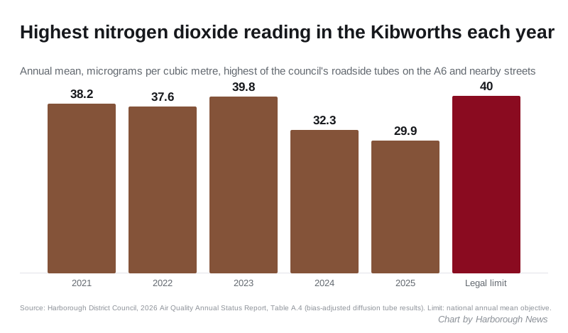
The highest Kibworth reading in each of the last five years was:
- 2021: 38.2, at the sign outside 64 Leicester Road (tube 34n)
- 2022: 37.6, same tube
- 2023: 39.8, same tube, just under the limit
- 2024: 32.3, same tube
- 2025: 29.9, at the signpost just north of 11 Leicester Road (tube 36n)
The automatic monitor on the A6 has never broken the limit. Its annual average fell from 32.2 in 2021 to 28.0 in 2025.
Not every street improved last year
The overall trend is down, but the 2025 figures were not lower everywhere. Selected Kibworth tubes from Table A.4 of the report:
| Tube | Location in the report | 2024 | 2025 |
|---|---|---|---|
| 34n | Sign outside 64 Leicester Road | 32.3 | 23.5 |
| 35n | Lamp post outside 78 Leicester Road | 26.5 | 20.9 |
| 31n | Lamp post outside 69 Leicester Road | 23.6 | 21.3 |
| 36n | Signpost just north of 11 Leicester Road | 23.1 | 29.9 |
| 38n | Coach and Horses | 15.0 | 22.2 |
| 39n | Lamp post 29, Church Road | 14.4 | 17.3 |
The report does not explain the rises at tubes 36n and 38n. Readings move from year to year with the weather, the Cabinet report says. That is why the council waited for several years of results before asking to lift the zone.
The 2023 reading of 39.8 was also very close to the limit. The report notes that 2025 was the first year tube 34n came in below 36. That tube is about 30 metres from the automatic monitor.
Why the council is doing it now
Each year the council sends the report to the Department for Environment, Food and Rural Affairs (Defra). In its review of last year’s report, Defra said it supported revoking the Kibworth zone. It added that if the council kept the zone, it would have to update its action plan for the area, which dates from February 2019 and is more than five years old.
Across the district, no monitoring site broke the limit in 2025. Readings at homes near the roadside ranged from 12.3 to 30.0, the Cabinet report says. The council also has tubes in Lutterworth, Market Harborough, Theddingworth and Walcote.
Cllr Michael Rickman, Cabinet Lead for Community Safety, said in the council’s announcement: “The decision to revoke the Air Quality Management Area is based on robust evidence, and residents can be assured that air quality monitoring will continue in The Kibworths and across the district.”
What happens next
- The decision was subject to call-in, so other councillors can still ask for it to be reviewed.
- The revocation takes effect when the council signs a formal order. The draft order, published with the Cabinet papers, has the date left blank.
- The tubes stay where they are. The council says the results will also be used to check that new development does not make air quality worse in the Kibworths.
What it means for you
If you live on the A6 through Kibworth Harcourt and Kibworth Beauchamp, the council’s own figures say the air by the road has met the national standard every year since 2020. Lifting the zone does not remove the council’s duty to act. If readings go back over the limit, the law requires it to consider declaring a zone again.
You can see the monitoring maps and past reports on the council’s air quality pages. The Cabinet report, the full annual status report and the decision list are on the 26 October meeting page.
Have your say